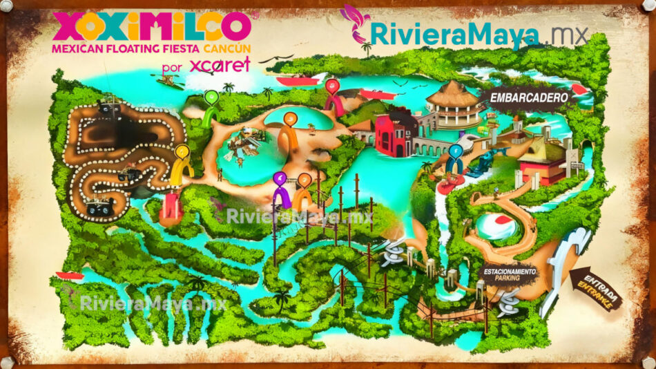
Xoximilco Cancún is a park that pays homage to the lacustrine tradition of Xochimilco in Mexico City, creating a vibrant Mexican fiesta on the water. With a network of canals, having a map will help you locate all the key points to experience it to the fullest.
Xoximilco is a park belonging to the Experiencias Xcaret group, famous for its colorful trajinera boats, typical music, delicious food, and festive atmosphere.
What can you see on the map?
The Xoximilco map focuses on its extensive network of canals, but it also marks important points for your visit:
- Embarkation Point: The start and end point of your journey, where you will board your trajinera boat.
- Parking.
- Entrance.
- Canals: The network of waterways you will navigate. Each canal has a name related to Mexican culture (like Canal Zapata or Canal Allende).
- Bridges: Picturesque bridges connecting different sections of the canals.
How to get to the trajineras?
Access to the trajinera boats is very straightforward and clearly signposted: Upon arriving at the park, you will pass through the ticket booth and reception. A path will lead you directly to the main embarkation point. Park staff will assign you a trajinera (usually by group number or reservation) and guide you to it to begin your adventure.
Time required
The Xoximilco experience has a fixed duration of approximately 3 hours, which is the length of the trajinera boat ride. Arrive at least 30 minutes early for check-in.
Download PDF
Download the map to zoom in on your phone and plan your fiesta night.
Download PDF Map 744 KB. 74 Downloads.


